
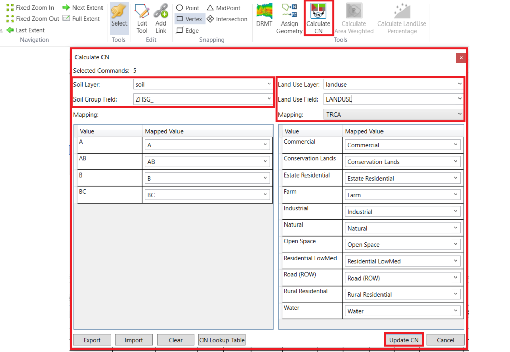
Now, the model structure has been created. All parameter values except NasHyd area and RouteChannel length are using default values. GIS layers can help determine some parameter values. In this example, the soil layer and the land use layer will be used to estimate the CN values of NasHyds.
Open the Calculate CN tool. Fill the popped-up window as shown below. The mapping table could be loaded from file CN.mapcn in the GIS data folder. Click Update CN to start the process.
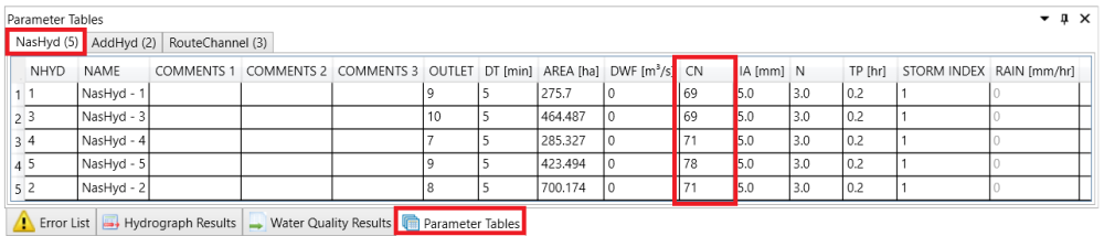
Once calculation is finished, close the Calculate CN tool. In the NasHyd parameter table, check how the CN number has been changed.
Copyright © 2025 Smart City Water
—
Powered by 