
Support Layers are added to help define rain gauges (Raingauge), display the type of hydrologic objects (Command) and display connections between hydrologic objects (Connector and CatchmentLine).
- The Raingauge layer displays rain gauge on the map. It is used in DRMT (7.6.3) to define the location of rain gauges.
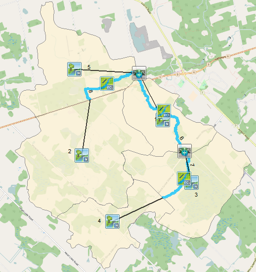
- The Command layer shows hydrologic object icons on top of GIS features as shown in the figure below. Users may find it helpful when differentiating hydrologic objects. For polygon-hydrologic objects, the icon is shown at the centroid of the polygon. For polyline-hydrologic objects, the icon is shown at the middle point of the polyline.
- The Connector and CatchmentLine layer are virtual connection lines representing the connection between certain hydrologic objects, which is similar to the link in Schematic View. The CatchmentLine layer represents the connection starting from a catchment. All other connections are represented by the Connector layer. The connections are represented by a straight line as shown in the figure below.
Copyright © 2025 Smart City Water
—
Powered by 