
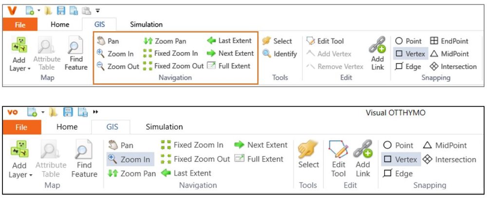
To zoom in and out of the map, wheel the scroll mouse up and down. More navigation tools are available in GIS tab and they are shown below. These tools are described in Table 4-4. The Pan tool is also available from the context menu. Note that in TatukGIS, the Zoom Out button is not available. Instead, To Zoom In, the user can click on the Zoom In button followed by clicking and moving the mouse to the right side to form a rectangle. To Zoom Out, follow the same step above but forming the rectangle towards the left after clicking on the map. The user can always use the scroll mouse to zoom in and zoom out. Identify button is only available in ArcGIS. Multi-selection of Snapping tools is available only on ArcGIS.
The scale of the Map View and Schematic View is synchronized by default to zoom to same hydrologic objects, which works best for the split view. The synchronization can be turned on/off in Options window. Turning off the synchronization would improve performance for a model with many hydrologic objects.
The two views can also be synchronized manually by choosing the Show Same Hydrologic objects as in Schematic View in map context menu or the Show Same Hydrologic objects as in Map View in schematic view context menu.

Note that the views are not synchronized when it is not in split view model even when the synchronization is turned on. Please use the manual synchronization context menu when switching to another view.