
VO provides tools to create hydrologic objects on map. Different from the Schematic View, the geometry needs to be digitized on the map before the objects can be created. To create a hydro-logical object on map:
- Turn on the base map layer for reference.
- Configure the snapping environment in the GIS tab to snap certain point on existing shapes. Their usage is described in Table 7-3. It can be changed anytime during the digitization process. Notice that only Vertex is selected by default.
TABLE 7-3 SNAPPING TOOLS
| Icon Command | Icon Command | ||
|---|---|---|---|
 |
Point Allows to snap to a point. |
 |
EndPoint Allows to snap to the end point of polyline or polygon. (Available only in ArcGIS) |
 |
Vertex Allows to snap to the vertex. |
 |
MidPoint Allows to snap to the middle point of a polyline |
 |
Edge Allows to snap along the edge of polyline or polygon. |
 |
Intersection Allows to snap to intersection of two geometries |
- Specify the type of new hydrologic object by:
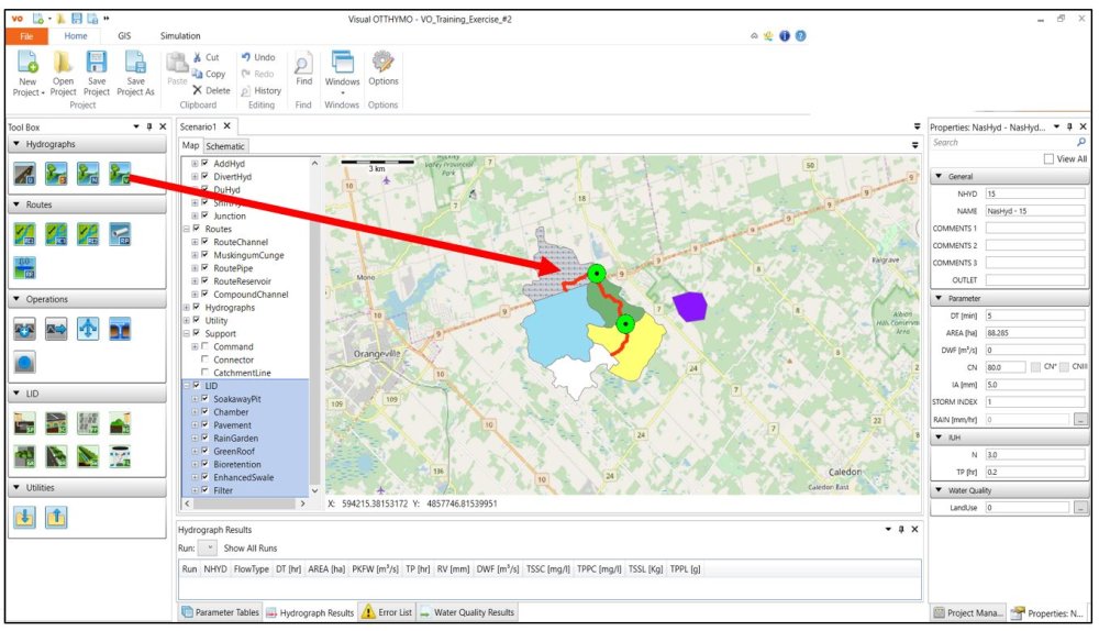
a. Dragging and dropping the hydrologic object icon from the toolbox to Map View.
![]()
Or, b. Selecting the type of hydrologic object from map context menu.
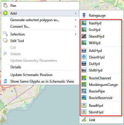
Notice that the cursor changes to a pencil shape indicating it is ready to draw on map.
- Start to draw the desired shape on the map by clicking on the map.
For point-hydrologic objects (e.g. AddHyd), the hydrologic object will be created immediately when a point is created.
For line-hydrologic objects (e.g. RouteChannle), it requires a starting point and an ending point. Snap and click on a point command where the line starts from, and click to add vertex if needed for the line. To finish the sketch, snap and click the point command where the line ends.
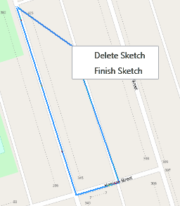
For polygon-hydrologic objects (e.g. NasHyd), multiple points are required. To finish the sketch, either right click to open the context menu as shown below that allows users to delete or finish the sketch or press the ESC key.
![]()
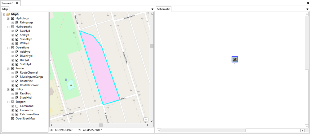
- With the newly created shape, a new feature is created in the corresponding layer. A hydrologic object is also created and selected in both views.
![]()
Copyright © 2025 Smart City Water
—
Powered by 