
Three different types of watersheds were examined in this study; a rural watershed, an urban watershed and a mixed land use watershed. Two rural watersheds in southern Ontario were tested, one was large and had an area of 6540 ha. the other was small having an area of 44 ha.
Simulation runs were also conducted on three southern Ontario urban watersheds. The catchment characteristics are summarized in Table 5.
TABLE 5 URBAN WATERSHED CHARACTERISTICS
| Watershed | Area (ha.) | Imperviousness (%) |
| No. 1 | 294.4 | 35 & 50 |
| No. 2 | 290.3 | 50 |
| No. 3 | 150.5 | 30 |
On two of the catchments the urban area routine URBHYD of OTTHYMO was used. Impervious conditions of 35% and 50% were used on urban catchment No.1 to observe the change in difference between the design storm peak flows. On the third urban catchment the SWMM simulation program was used. A schematic of this catchment is shown in the figure below.
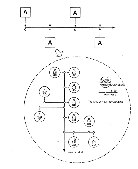
SCHEMATIC OF CATCHMENT NO. 3
A mixed land use watershed in Metropolitan Toronto, having a rural area of 1597 ha. and an urban area of 5536 ha., as also tested. The flows on this watershed were found using the OTTHY-MO model. The total area contained 21 urban subwatersheds and 12 rural subwatersheds. They ranged in size from 53 ha. to 778 ha. The urban subwatersheds had an imperviousness of 35%.