
According to the site’s contour map, its topography is fairly homogenous and no well-defined channels exist within the basin which means that mainly overland flow takes place. There are no roads or other local impervious areas and the type of soil is similar throughout the watershed (Sharpsburg silt loam). Therefore, no disaggregation is required based on the spatial distribution of catchment properties, and therefore, we will add one Subcatchment command for the undeveloped condition.
Then, we will add one Outfall node at the outlet of the Subcatchment. The Outfall node will be connected to the Subcatchment to receives runoff from the Subcatchment. The Outfall node can be considered as a monitoring node where later we will compare the runoff between pre- and post-development conditions.
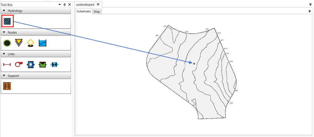
Add a subcatchment
To add a Subcatchment, drag and drop the Subcatchment command from the Tool Box to the desired location on the Schematic view.
Add a outfall node
To add a Outfall node, drag and drop the Outfall node command from the Tool Box to the desired location on the Schematic view.

Connect subcatchment and outfall
To add a connection from the Subcatchment to the Outfall node, move the mouse on top of Subcatchment. When the mouse cursor changes to a cross, click and hold the mouse left key, and drag towards Outfall node. When moving the mouse cursor on top of Outfall node, release the mouse left key to add a connection line.
