
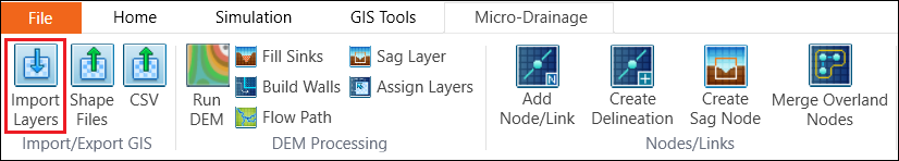
Click the Import Layers button from the Micro-Drainage tab.
In the pop-up window, the Layer field chooses Junction from the drop-down list.

Click the button next to the Input Source field to open the import window.
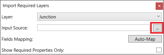
Select “…\Data\Manhole.shp” and click Open.

Then, click the Load button on the Import Required Layer window.

In the pop-up window, choose and Open the mapping file “…\Data\Junction.mapjunction”

The layer properties will be automatically mapped with the model properties. Click Import.

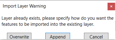
In the pop-up warning message window, click Overwrite.
In the Enumeration Mapping window, make sure mapping the categories as below and click OK. Then, the Junction layer will be successfully imported.

Close the Import Required Layer window. In the layer tree of the map, expand the layer tree of Node layers. Right click on the Junction layer and select Zoom to layer.

The Map will display as below. If the location of the manholes is not the same as the in the figure below, please check and change the coordinate system using Layer Properties.
