The delineation node is used to cut catchments into pieces and bring several branches into one subcatchment.
A Delineation Node is always connected to a Major Node. To add a delineation node, first move and zoom in the map to the upstream of the south branch, and then click the Create Delineation button in the Micro-Drainage ribbon. The Feature Selection window will pop up and the mouse cursor will change into the editing mode. Select the Major Node on the map. The selected Major Node will be shown in the Selected Major Node field on the window of Create Delineation.
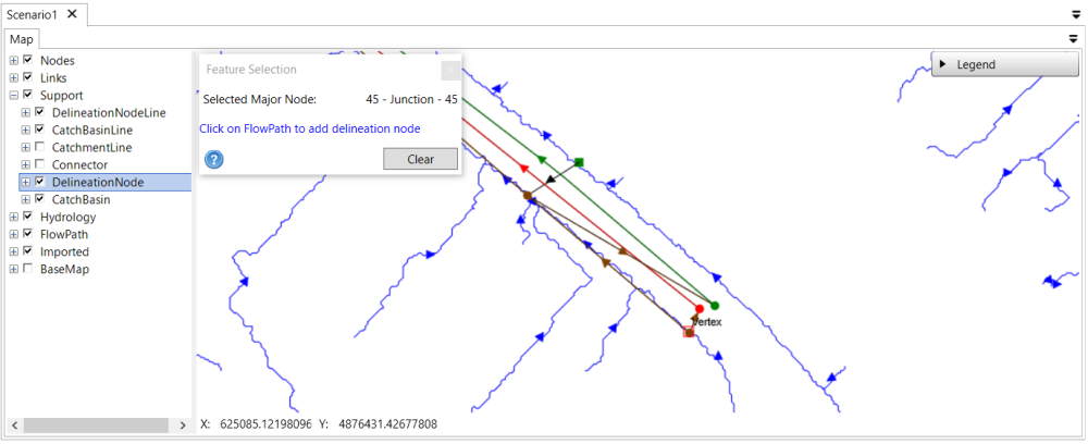
Then click on the flow path to add a delineation node. It is recommended to add the delineation node to be perpendicular as much as possible to the flow path. To see the connection line between the major node and the delineation node, make sure the layer DelineationNodeLine under the Support layer is checked on in the map layer tree.
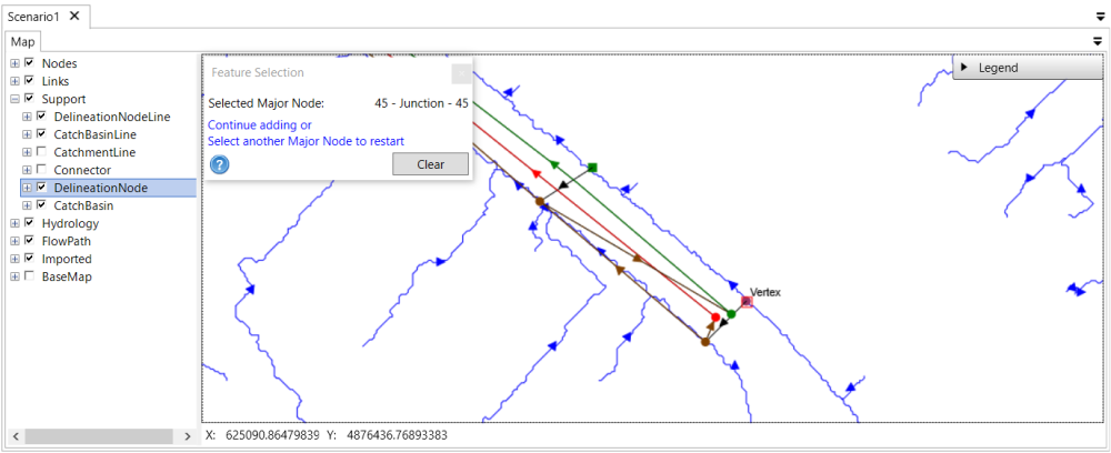
To add the delineation node for the next major Junction node, keep the Create Delineation window open. Click the desired major Junction node, check the Selected Major Node field is updated and then click on the flow path.
Tips: Users can keep the Feature Selection window open while navigating on the map to different locations by scrolling the mouse to zoom in/out or holding the middle wheel to pan the map. In case that the desired location is far away from the current location, users can close the Feature Selection window, navigate to the desired location and then reopen the Feature Selection window.
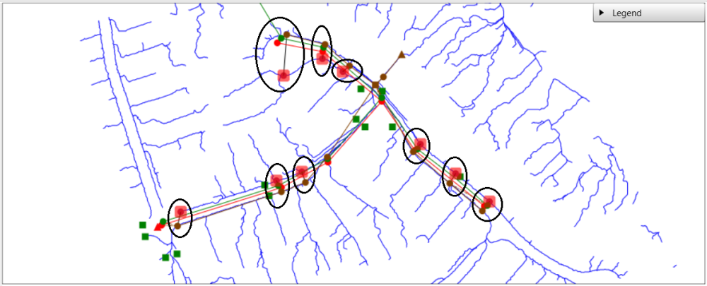
The locations of all the delineation nodes are shown below.