
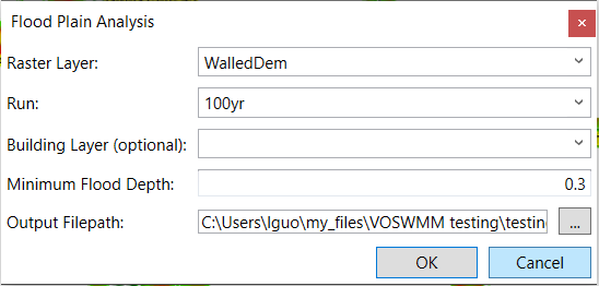
Click the Flood Mapping button. In the pop-up window, choose the ground elevation raster from the drop-down list of Raster Layer, and choose the run to be analyzed in the drop-down list of Run. In the Output File Path, give the folder and file name for the flood plain raster to be generated. Click OK to generate the flood plain raster.
The generated flood plain raster will be added to the map and the layer table of the map.

Copyright © 2025 Smart City Water
—
Powered by 