
This section includes the following tools.
![]()
DEM Transect
User can directly obtain the transect of the road from the DEM and assign that to a major system conduit. To do that, first select a conduit on the map. Then, click the DEM Transect button. When the mouse cursor changes to the Edit mode. Click on the one side of the road and the click on the other side of the road. The Assign Channel Cross Section window will pop up with the measured transect table and curve shown in the window.

Cross Section
This tool allows users to obtain the transect of the road by combing the DEM and field survey data. Click the Cross Section button to open the Cross Section window. From the drop-down list, select DEM layer, Survey Point layer and Elevation Field name used by the survey layer. Click on the Map at the desired location where to read the data. If users click on the survey data point, the survey data will be used and written in the transect table on the left of the Cross Section window and plotted on the graph; otherwise, the DEM data will be used. Users can draw a box on the Map to select all the desired survey points.
Users can delete the points from the transect table by selecting the row to be deleted and press the Delete key on the keyboard.
The Left Bank and Right Bank locations will be automatically identified from the transect table and shown as red dots on the graph. Users can also assign Left Bank location to different points by right-clicking on the transect table and select Set as Left Bank Station in the opened context menu. The same procedure is applied for Right Bank location.
Click Edit Parameter button to show the parameter table of the transect and allow users to edit parameters.
Click Assign to Overland Link button and then select overland links on the Map to assign transect curves. For multiple selection, simply hold the Ctrl key while selecting.
Click Save button to save the transect table into Curves database.
Click Restart to clear the selection and transect table.

Fix Irregular Transect
This tool is used to fix the irregular transect to prevent the depth of the irregular transect from being too shallow. Click the button Fix Irregular Transect. In the pop-up window, type the minimum depth requirement for the irregular transects.

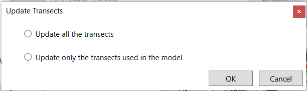
Click OK in the Fix Irregular Transect window. The following message box will show up. Users can choose whether to update all the transect curves in the database or just the ones that are used in the model.
The transects will be updated by the following rule. If the depth of existing transects is higher than the minimum depth requirement, then no update will occur. Otherwise, increase the elevation on each side of the transect to meet the minimum depth requirement.