
The atmosphere is constantly rearranging itself into areas of high and low pressure due to a range of factors. Air is accelerated in the form of wind from areas of high pressure to areas of low pressure. The greater the pressure difference (or gradient) between the two areas, the stronger the wind will be. In the Southern Hemisphere, winds circulate clockwise around low pressure, and anticlockwise around high pressure. These winds are the driving force in wave generation.
The charts below show the relationship between pressure systems and wind. The synoptic chart shows high- and low-pressure areas, with lines connecting areas of equal pressure (isobars). You can see how these pressure systems are reflected in the wind patterns shown in the chart underneath. The closer the lines on the synoptic chart, the greater the wind speed and therefore wave strength and height.
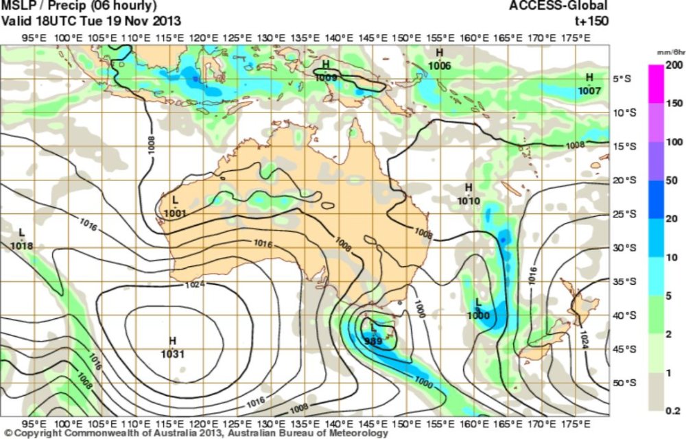
Chart 1 – Interactive weather and wave forecast[11]
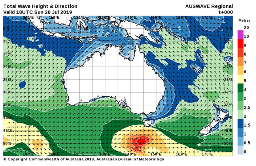
Chart 2 – Total wave height and direction forecast[12]