
From MapAnalyzer…
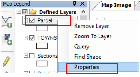
RIGHT-CLICK on the Parcel Layer in the Map Legend
CLICK on Properties
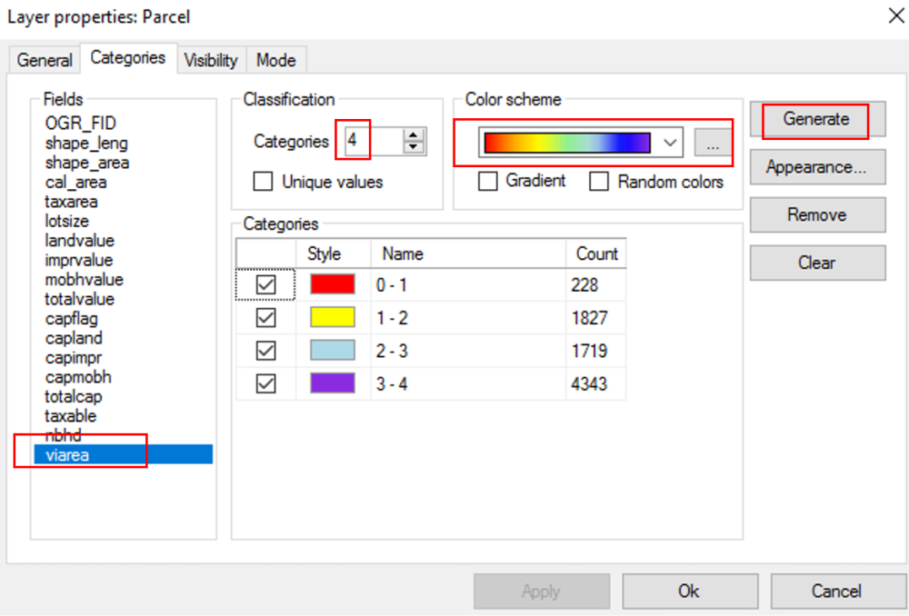
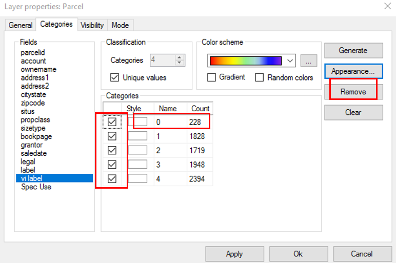
Under the Categories Tab…
CHANGE the Categories to 4
SELECT the viarea (under fields)
NOTE: If you don’t see viarea, check the unique values box
CHOOSE the Color Scheme …
CLICK Generate
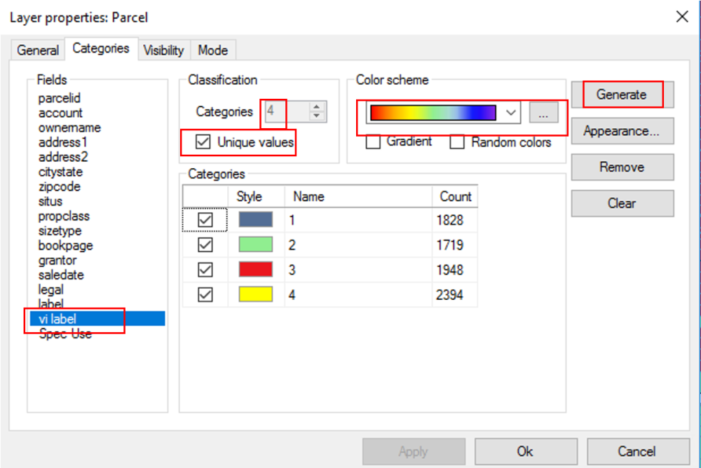
OR
CHANGE the Categories to 4
SELECT the Unique Values Box
SELECT the vilabel (under Field)
CHOOSE the Color Scheme
CLICK Generate
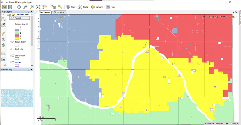
The categories will then display as above.
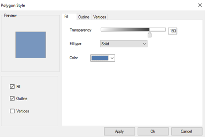
From here, user can DOUBLE-CLICK on the style box for each category to assign the options.
The options must be set as below for the Visual Inspection Plan.
Year 1 = Blue , Year 2 = Green, Year 3= Red, Year 4 = Yellow
SELECT fill, color, and transparency
CLICK Apply and Ok.
DO this for each year.
To print a Visual Inspection Map…
CLICK Print on the toolbar
CHOOSE Map Page
A map page pdf will open.
CLICK printer icon to print.
To clear the categories
CLICK on each line and REMOVE, APPLY, and OK.
OR – If you would like to leave the categories visible and only turn them off, just UNCHECK the boxes to the left of them.
Post your comment on this topic.