
 MapAnalyzer now allows for user to fix the shapefiles.
What this fixes:
- User gets kicked out when trying to edit layer.
- Issue of incomplete polygons, self-intersecting polygons, or polygons drawn counterclockwise. (User should draw polygons clockwise.)
- Ag Land Summaries are not calculating soils or use
- Splits being initiated are failing
- Error message displays when trying to edit the map.
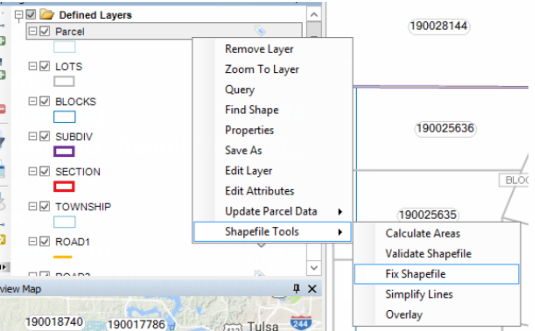
To fix the Shapefile:
SELECT the shapefile you wish to fix under the map legend

RIGHT CLICK
Shapefile tools — Fix Shapefile
The fix shapefile box will appear.
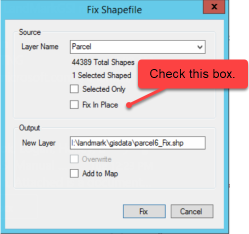
SELECT the layer you wish to fix
CHECK the fix in place box. This removes the output and fixes the shapefile in place.
Once that box is check select fix. This will go through and validate the polygons contained in the shapefile and any errors will be fixed.

SELECT YES If a box appears to remove any invalid polygons

After the shapefile is fixed you can view the log that is created. You will see the shape id of the polygon and the issue that was fixed.

CLICK Yes to view report

Feedback
Copyright © 2025 LandMark GSI
—
Powered by 
Post your comment on this topic.