
A Construction Layer is handy for mappers that like to try a split (or whatever) in a layer first, before doing it live in another layer.
Creating a Contruction Layer
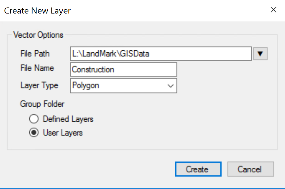
CLICK Create New Layer Button 
The Create New Layer box will open.

NAME the new layer
CHOOSE Polygon for a construction layer
CHOOSE Defined or User Layer (usually a user layer for this type)
CREATE
The new layer will show under User Layer.

Edit Attributes to include the attributes you want.
Before

After

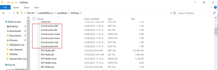
CHECK to see if File Explorer — GISData has layer name (Construction) with .prj file
This example doesn’t.
If not…
COPY ANY .prf file
PASTE
RENAME the .prj file with new layer name (Construction)

SELECT the parcel (in the construction layer—that is to be split)
DRAW a polygon (in order for this layer to save)
APPLY and exit Edit Mode

SAVE MAP STATE
Idea on how to use a Construction Layer:
Construction layers are handy for mappers who want to avoid using the exceptions tab when a split that is in the middle of a polygon (because that goes off the same waypoint). Example: If you are mapping a whole section, and you have to cut out a shape in the middle of the section, instead of doing the exceptions you can create map the new parcel in the construction layer. Then when doing a split, turn on the construction layer OVER the layer you’re doing the split in and split by keyboard instead of COGO.
Post your comment on this topic.