
The parcels for specific area can either be:
- Selected in the map (this example)
OR - If it is an odd shape and not easy to select them all at once SELECT through an index in Landmark.
Tools — GIS Tools — Plot Index
The map will open. It will take a bit to load.
When it does, the selection box will pop up.
CHOOSE New Layer with Parcel Attributes.
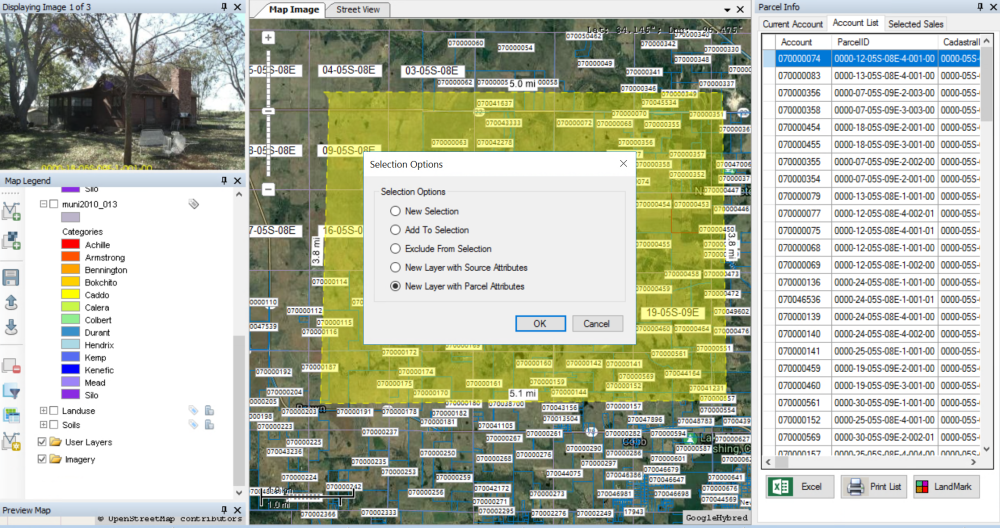
The new layer will be created and then appear under the User Layers in the Map Legend.

RENAME layer
RIGHT-CLICK on layer (Selection in this example)
CHOOSE Properties
TYPE-IN new name
CLICK OK

Layer name will update.

RIGHT-CLICK on the new layer
CHOOSE Save as
CHOOSE a folder to save to
NAME it

COPY All four files to flash drive or send to compressed zip file to email.

Feedback
Copyright © 2025 LandMark GSI
—
Powered by 
Post your comment on this topic.