
Print Ownership Listings (parcel listing) of any area on map.
Areas from the map could be, but aren’t limited to the following: fire district, city, neighborhood, school district etc…
Note: A School District in the LandMark/MapAnalyzer system is the ACTUAL school district. This is DIFFERENT than in the ‘school districts’ in the old system, which LandMark calls tax areas. A single school district may be found in multiple tax areas. Check out the documentation on how to build an Ownership List of a Tax Area.
This example will show how to…
- Build a shapefile of a city
- Open that index in LandMark
- Print an Ownership Listing
CHOOSE the layer that contains the category to build index of.
It will turn gray.

SELECT area on the map (Ex: City of Achille)
The area will turn yellow.

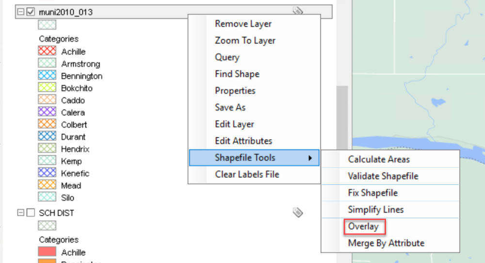
RIGHT-CLICK on the layer.
Shapefile Tools — Overlay
The Overlay Layers box will open.

CHECK Selected Only under First Layer
CHOOSE Parcel under Second Layer
CHOOSE Intersection under Operation
RENAME the New Layer
CHECK Add to Map
CLICK OK
The box will close.
RIGHT-CLICK on the same layer

CHOOSE Save As
A box will open.
Make sure the top box matches LandMark (L): > LandMark > GISData >
TYPE-IN new File Name and SAVE
This will save that layer as a shapefile.
CHOOSE Parcel Layer (will turn gray)
GO TO Tools — Select by Shapefile
CHOOSE the desired shp file (AchilleParcels)
OPEN

The Selection Options box will open.
CHOOSE the New Selection and OK
A parcel list of the new layer should generate on the right side in the Parcel Info area, under Account List
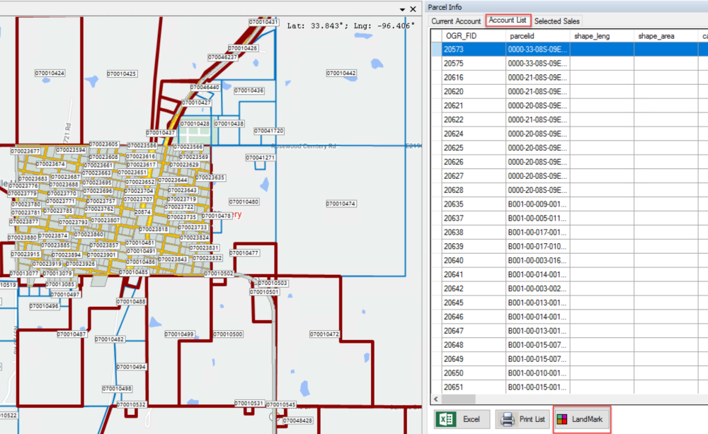
CLICK the LandMark Button to build an Index in LandMark
A window will open.
CHOOSE Temporary Index and OK

GO to LandMark
The Assessment Record should be in an Index.

File — Print — Assessment Report — Ownership List
An ownership list will generate.
If you want a map and account listing, CHOOSE Print List instead of LandMark.

Post your comment on this topic.