
Categories can be created for layers such as the Use and Soil Layers to differentiate between the various types.
To create a Category…
RIGHT-CLICK on the layer in the Map Legend for which the categories are desired
CLICK Properties.
The Layer Properties box will appear.
CLICK the second tab labeled “Categories”.

CLICK “Color Scheme” drop-down to select the desired color variation.
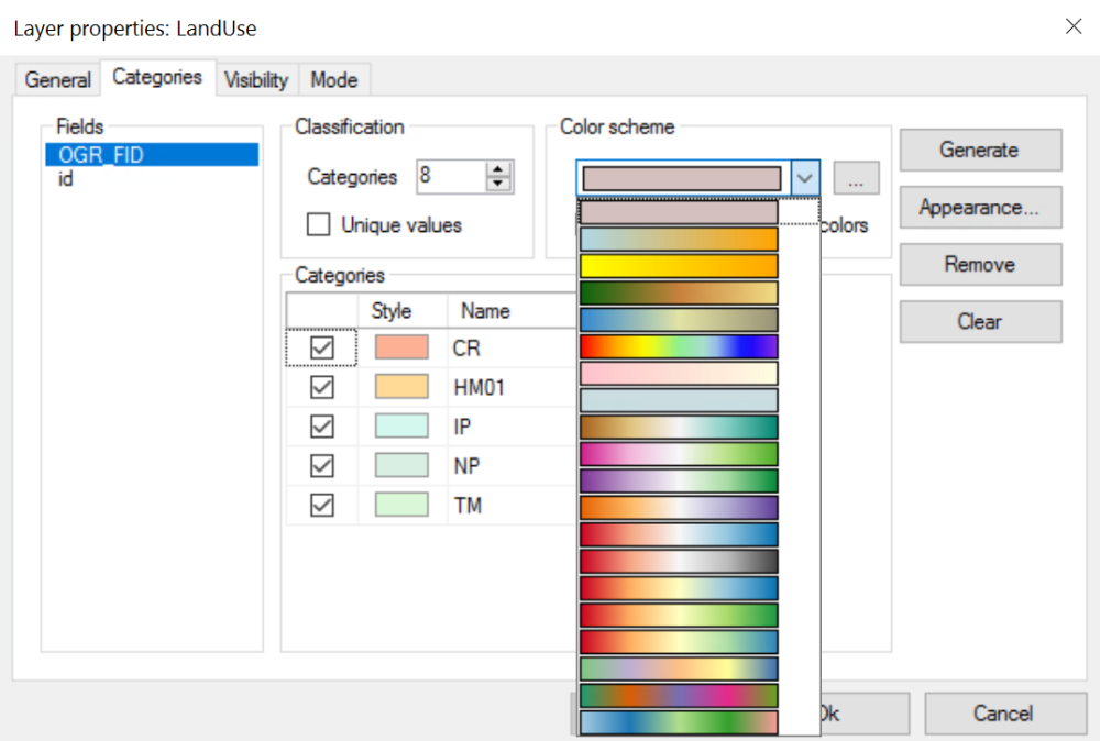
Once the color is selected:
CLICK Generate to create the random color scheme.
The transparency of the colors can then be edited by clicking on Appearance.
The Category Drawing options box will appear.
Here the User can change the Transparency, Fill Type, and Color if desired.
The Outline of each type and the Vertices colors can also be edited from here.
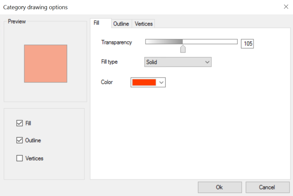
CLICK OK to apply the changes in the Category Drawing options.
CLICK Apply/OK to apply the changes made to the categories.
Post your comment on this topic.