
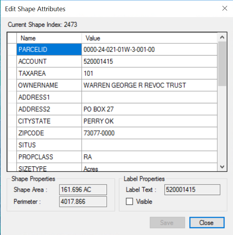
Edit Shapefile Attributes on a Single Polygon
SELECT the polygon
RIGHT-CLICK
The attributes data will be display and can be edited.
Parcels connect from MapAnalyzer to LandMark by the account number. If the account number isn’t correct, choose the polygon, right-click, add account number and save. The other account information will then populate.
To edit the attributes for the entire layer:
SELECT the layer to edit in the Map Legend panel
RIGHT-CLICK and SELECT Edit Attributes
OR
Once the layer is selected CLICK the edit attributes

The Attributes Table Editor is displayed.

Tabular data can be edited on a row or in mass using the Tools – Field Calculator Tools.
Columns may also be added, deleted or renamed.
If the layer is in a database a user cannot add/remove fields in mass.
If needed, user can SAVE the layer as a shapefile. MODIFY IT, then REIMPORT it to overwrite the parcel shapefile.
Post your comment on this topic.