
GPS positioning uses orbiting satellites as a reference. On board each satellite is a very accurate clock and a transmitting radio. These are powered by batteries with solar panels which charge up the batteries while the orbit is in sunlight. Once a second, each satellite emits a signal with its ID and time. (The clocks are deliberately set fast to compensate for the curvature of space time to keep up with time on the earth. If they were not, GPS would drift by about 4km per day).
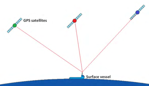
In each receiver, software knows the equations of the orbits of each satellite and calculates exactly where the satellite was when the signal was transmitted. It is also time synchronised with the satellites and
therefore can measure the time difference from transmission to reception which is converted to a distance in 3D space. This distance from the satellite location defines the radius of a sphere with its centre at a known latitude, longitude and height above the centre of the earth. Two spheres intersect with a circle and three or more define unique points on the surface of the earth. This raw position is good to about
5m. For oilfield positioning this is not sufficiently and so usually, the survey company will employ differential GPS.
Post your comment on this topic.