
This is covered in more detail in the Geodesy section above but here are some basic guidelines.
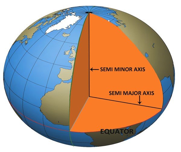
The Earth is elliptical in cross section due to the fact that the planet is mainly molten rock and the rotation of the Earth causes a slight ‘flattening’ as the centrifugal force throws the mass of liquid away from the centre of spin.
A datum by definition is an ellipsoidal model of the Earth and a centre point. Historically we have estimated the dimensions of the ellipsoid and its centre from surface observations and the best fit datum has naturally varied from region to region around the world. For example, in the USA, an elliptical model and centre point was chosen in 1927 and is referred to as the NAD 27 datum.
It uses the Clarke 1866 Ellipsoid (named after Alexander Ross Clarke a British Geodesist 1828 – 1914 with dimensions as follows:
Semi-Major Axis: 6378206.4 metres
Semi-Minor Axis: 6356583.8 metres
Whereas in 1983 the datum was updated to NAD 83 which uses a spheroid as follows:
Semi-Major Axis: 6378137 metres
Semi-Minor Axis: 6356752.3 metres
Not only did the shape update but the centre point shifted by several hundred feet. In order to correctly convert from one system to another, the latitude and longitude have to be converted to an XYZ coordinate from the estimated centre of the Earth (Geo Centric Coordinates). After that a shift in the coordinates to allow for the shift between the centre estimates is applied. Then the coordinates can be converted back to a vertical angle (latitude) and horizontal angle (longitude) from the new centre on the new ellipsoid. In some cases there may be a scale change and even a small rotation around the three axes so it is not recommended that a home-made calculation is done for such a critical and sensitive conversion.
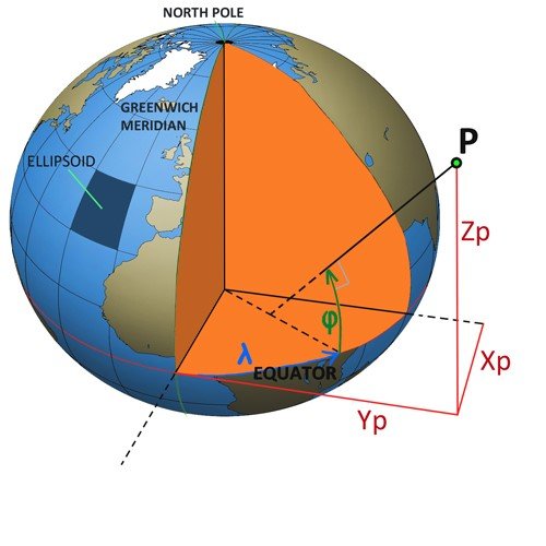
Latitude and Longitude for a point are NOT UNIQUE. They depend on the centre point and spheroid in use.
It is worth checking out the EPSG web site. This is the internet domain of the European Petroleum Survey Group which maintains an accurate database of geodetic parameters and provides on line software for doing such conversions.
Here, for example is the conversion of a point at 30 degrees North latitude and 70 degrees West Longitude from NAD 27 to NAD 83.
| Latitude | Longitude | |
|---|---|---|
| NAD 27 datum values: | 30 00 0.00000 | 70 00 0.00000 |
| NAD 83 datum values: | 30 00 1.15126 | 69 59 57.30532 |
| NAD 83 – NAD 27 shift values: | 1.15126 (secs) | -2.69468(secs) |
| 35.450 (meters) | -72.222(meters) | |
| Magnitude of total shift: | 80.453(meters) |
The main consideration here is that it is essential that when positioning a well, the geoscientists, the operator and the drilling contractor are all working on the same map system on the same datum as the shift in position can be enormous and frequently far bigger than the well target tolerance.
Post your comment on this topic.