
Adding
Helpful Hint: When user makes changes in the Ag LandTable, it DOES NOT change the land values in the Land Data Tab. User must make an Index for parcels affected by the particular change, while in the Index go to Tools — Recalc File and that will apply the updated changes to the Index.
Users can add land use codes to the Ag Land Table.
CLICK on the Land Use tab
RIGHT-CLICK and select add use.

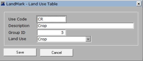
A form will appear
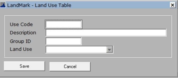
- Use Code: This code is what will display on your map, this can be a numerical number or an abbreviation.
- Description: The county description of the use being added
- Group ID: Users can put certain uses into a group number
- Land Use: The use type in which the use code being created will fall under.
FILL OUT form
SAVE
The land use will add to the table.
Delete a code
Users can delete any use codes.
RIGHT CLICK on the use code
SELECT delete
CONFRIM to delete the use
Feedback
Copyright © 2025 LandMark GSI
—
Powered by 
Post your comment on this topic.