
QP11 – Can the County Produce a Map of the Soil Types for Agricultural Parcels (68OS 2817 C) The County will print one map each for two parcels showing the Soil Type layer. The Parcels should be valued by Agricultural Use Type Methodology containing up to 160 Acres. (Copied from the 2023 Performance Audit Updated July 12, 2023)
How to Print a Soils Map for the OTC Audit.
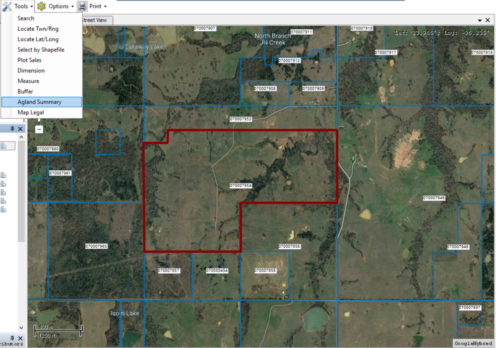
Open MapAnalyzer.
CHOOSE a parcel up to 160 acres
CLICK Tools and Agland Summary
The Agland Summary for that account will open.
CLICK the Print button.
The GIS Ag Land Soil/Use Summary will open.
User may print, convert to word doc or pdf, name the pdf and save.


Feedback
Copyright © 2025 LandMark GSI
—
Powered by 
Post your comment on this topic.