Keyhole Markup Language (KML) is a file format used to display SL-RAT data geographically based on GPS coordinates taken by the device. This file format is compatible with programs like Google Earth. You can download CSV files from the homepage or the View Measurements Page as described in the How to Export Data page.
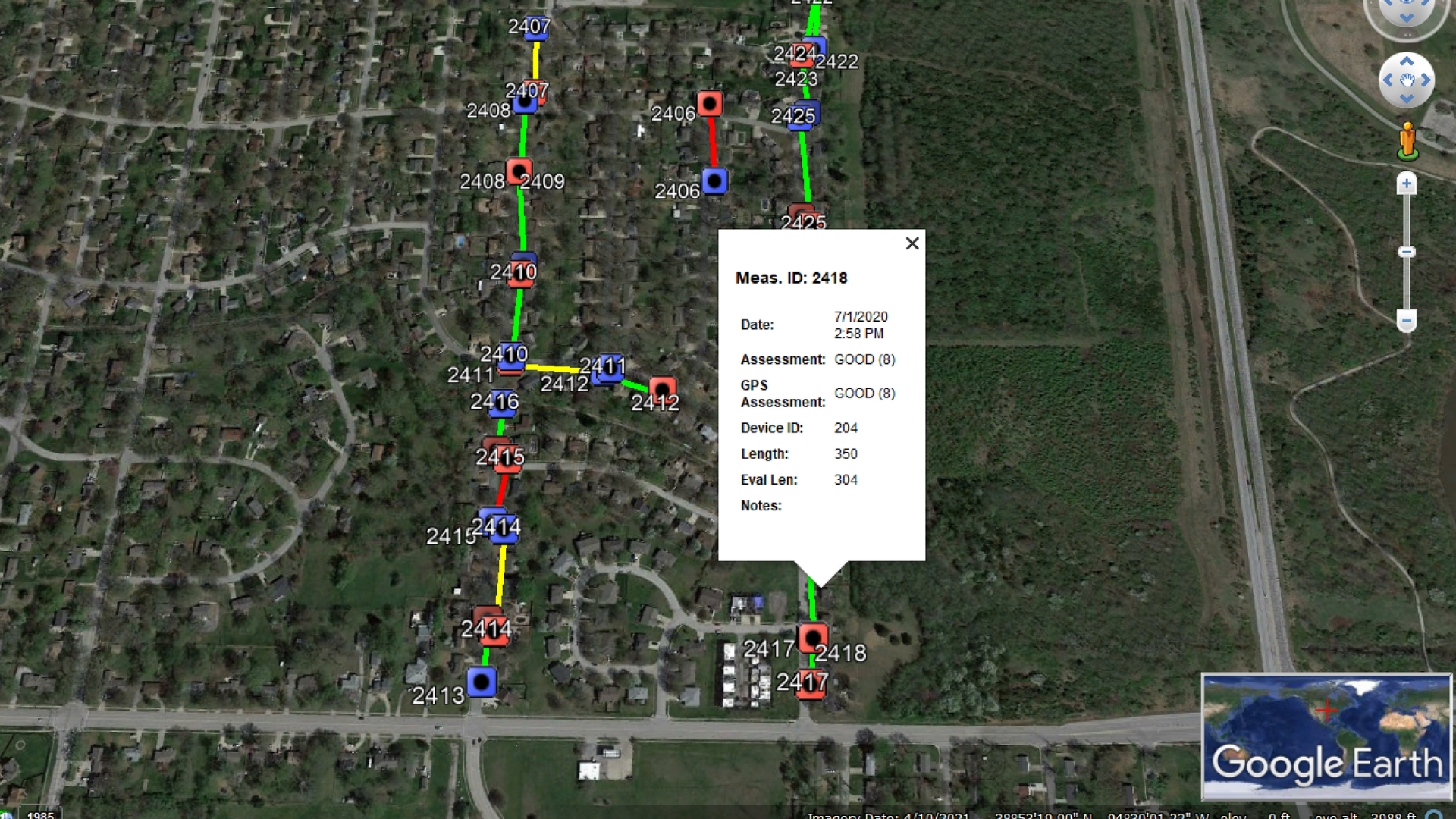
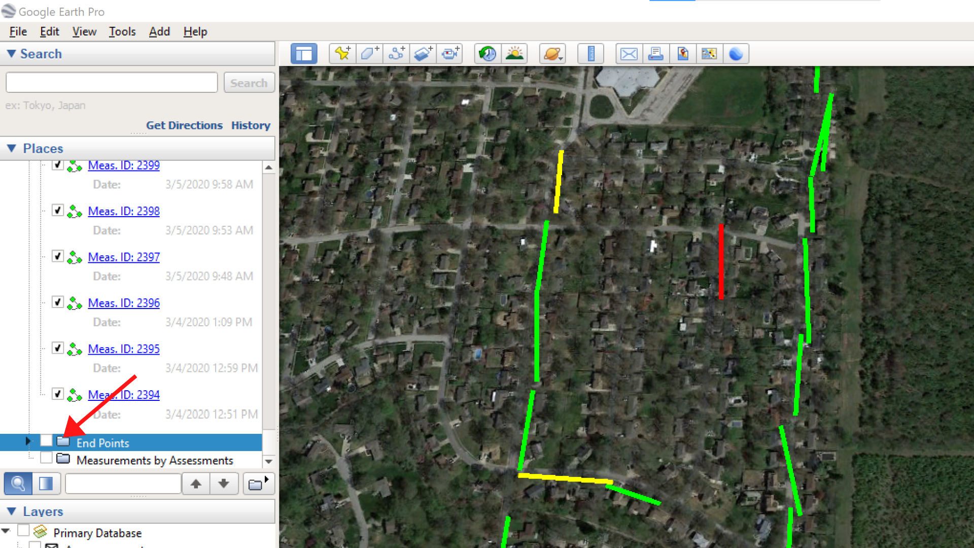
Example of KML File downloaded from SL-DOG:
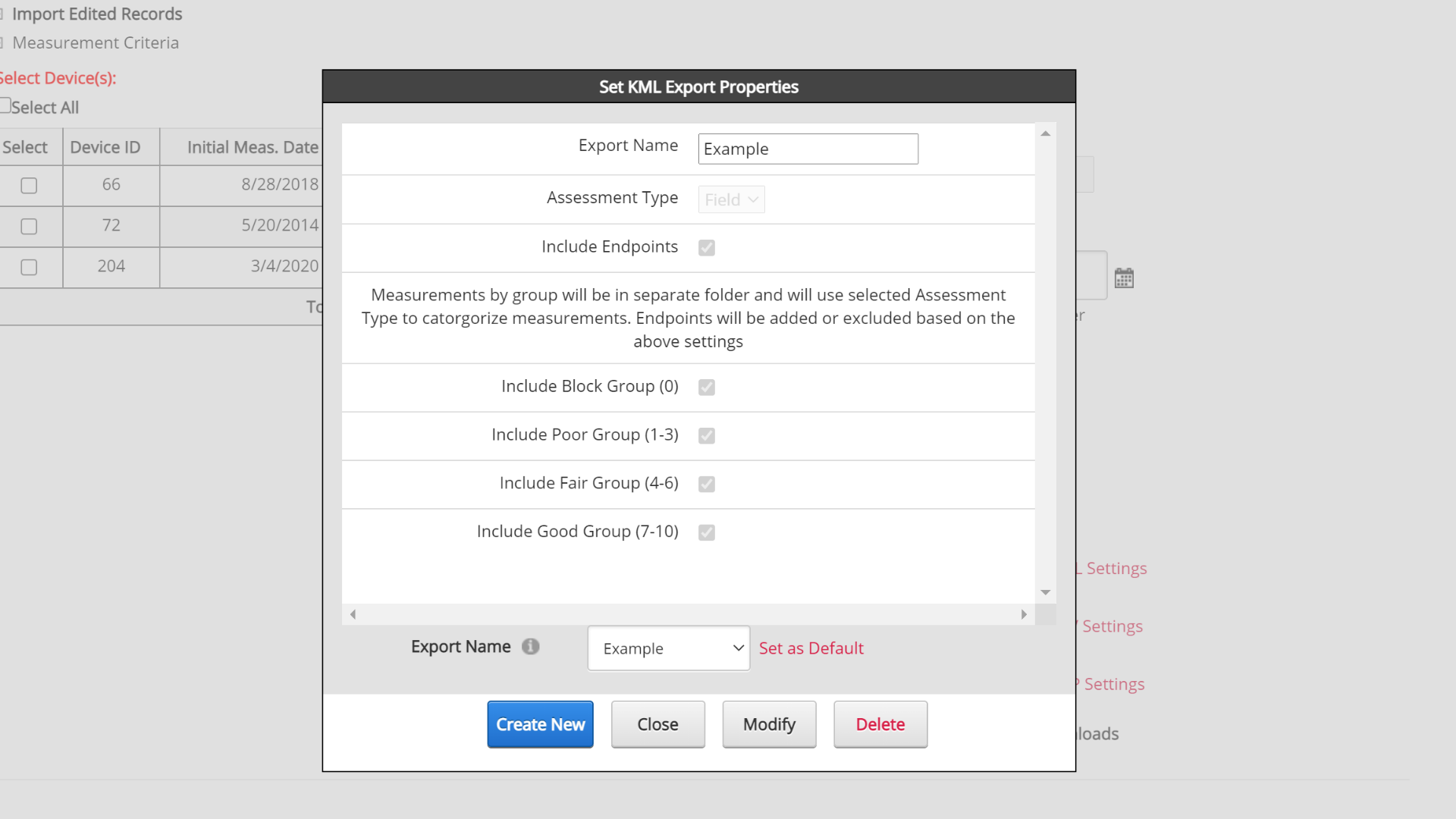
Create New KML File Settings
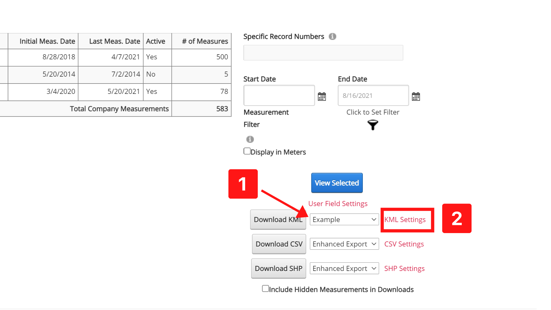
You can customize your KML file settings from the homepage, by following these steps:
STEP 1. Click “KML Settings” next to the download button.
STEP 2. Click “Create New”
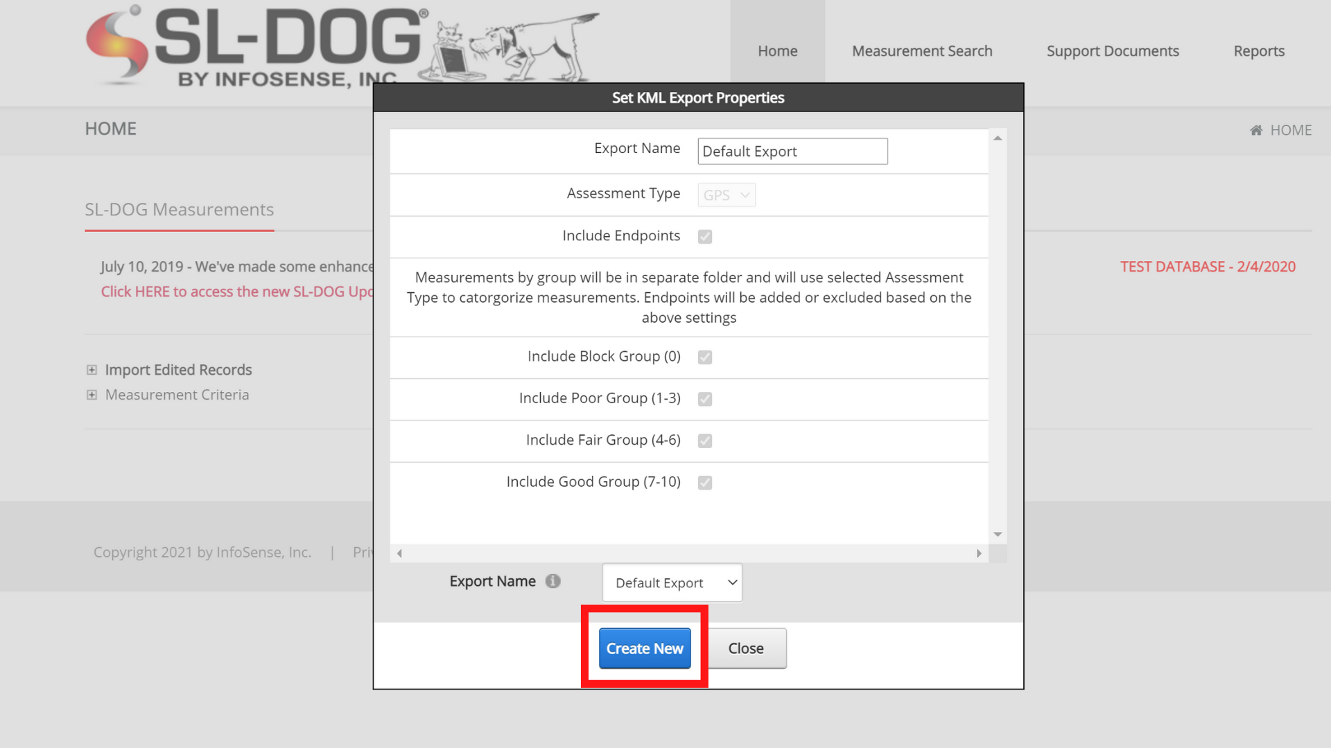
STEP 3. Fill out the form with desired settings
Export Name: Type in a name for the export setting (to find in the dropdown)
Assessment Type: Customize whether lines will be color-coded based on GPS Assess score or Field Assess Score.
Include Endpoints: Select box to include endpoints (manholes). If unselected, endpoints will not be included. Endpoints can also be unselected from Google Earth as well. Example of results without endpoints/manholes:
Include Block/Poor/Fair/Good Group: Unselect whatever measurements you would like excluded from your report.
Step 4. Click Save
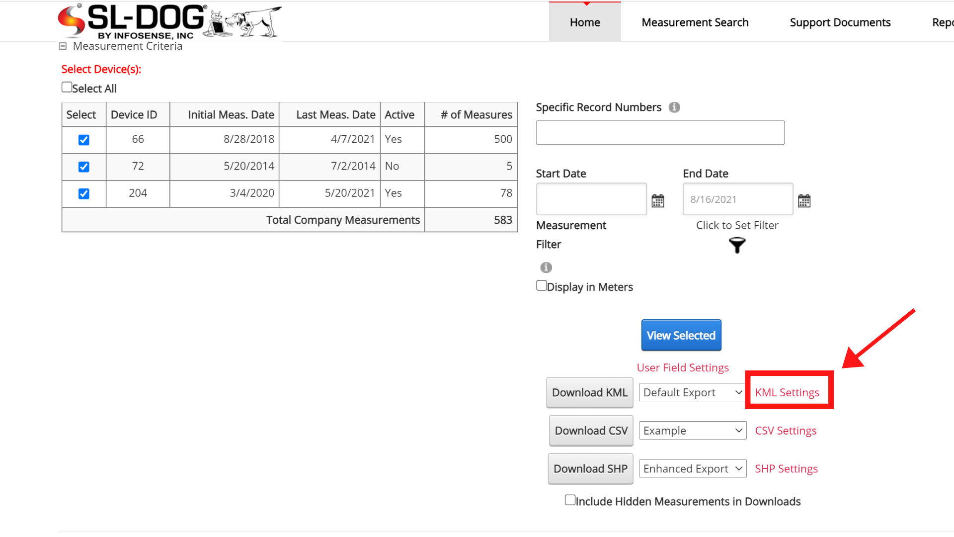
Once you click “Save”, the download setting will be selectable by using the dropdown next to the “Download” or “Export” button.
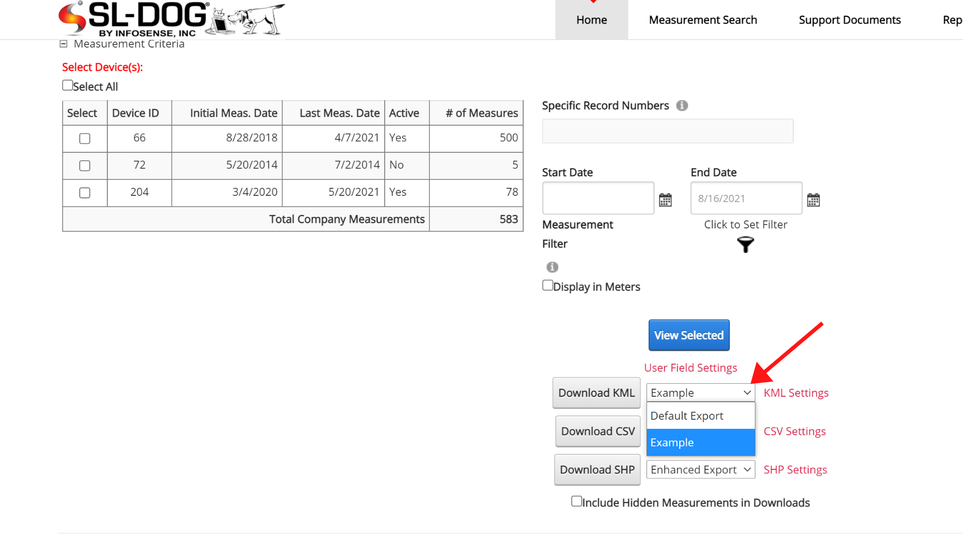
Deleting, Modifying or Defaulting an Existing KML Setting
To edit an existing KML setting, select the setting from the dropdown on the homepage and click “KML Settings.” The “Default Setting” that is the original default setting cannot be modified.
Create New: Click to create a new CSV setting
Close: Click to exit editing pop up screen
*Modify: * Make changes and click to update setting
Delete: Click to delete selected CSV setting
Set as default: (located next to Export Name) Click to set selected setting as the default, which means that this setting will be preselected. However, all other settings are still available in the dropdown). If the setting is already the default, this option will not show up.