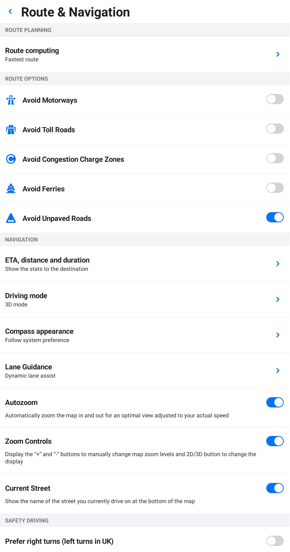
Route Planning
Choose in what way you prefer to reach your destination:
- Fastest – in the shortest time
- Shortest – in the shortest distance
- Economical – with optimal fuel or battery consumption
Route Options
You can select to avoid the following road types:
- Highways
- Toll Roads
- Congestion Charge Zones
- Ferries
- Unpaved Roads
Enable EV Routing
When creating a route with your electric vehicle profile for the first time, the app will ask whether to enable or disable EV routing. You can also turn this feature on/off anytime in Menu – Settings – Route & Navigation – EV routing.
Navigation
ETA to destination or waypoint
The app displays an estimated time of arrival (ETA), distance, and duration at the bottom of the navigation screen. These can inform you about the whole route or just until the next waypoint.
Set your preference in Menu – Settings – Route & Navigation – ETA, distance, and duration.
Driving modes
Select your preferred driving mode:
- 2D: Birds-eye map view.
- 2D with North up: Birds-eye map view that always points north to prevent map rotation.
- 3D: Tilted perspective.
Compass appearance
The Compass icon can be either in the world style (a classic needle) or the US style (an abbreviation of cardinal directions).
Additional features
Enable or disable these features:
- Lane Guidance: Highlights the lanes you should drive in to get a clear look ahead before changing lanes on highways or multi-lane intersections.
- Autozoom: Automatically zooms the map in and out for an optimal view adjusted to your current speed.
- Zoom Controls: Displays the + and – buttons to zoom the map manually and the 2D/3D button to switch the map view.
- Current Street: Shows the name of the street you’re currently driving on at the bottom of the map.
- Prefer right turns (left turns in the UK)