
Datasets are an exact copy of what the data was on a certain date and can be created at any point in the year.
Data Extracts may be taken from Datasets.
LandMark encourages counties to create new datasets at least twice a year: AFTER values have been set for the Excise Report and AFTER the Tax Roll has been created.
To View Datasets:
Main Menu — System — Dataset Management
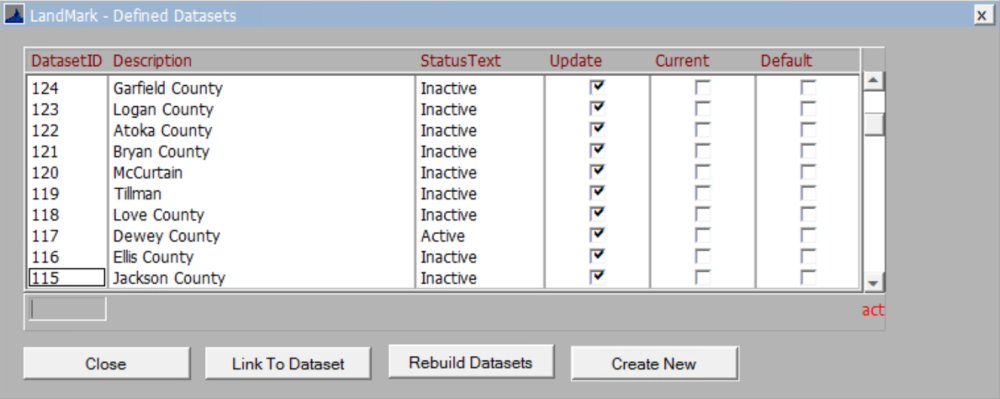
The Defined Datasets box will appear.

Close: Closes Window
Link To Dataset: IT USE ONLY
Rebuild Dataset: Doesn’t do anything.
Create New: Creates new dataset (see below).
Right-Click Dataset Menu
Set As Current: CHOOSE to set highlighted dataset to current
View Details: CHOOSE to view details of the highlighted dataset
Delete: CHOOSE to delete the highlighted dataset
Refresh: ENDUSER: DO NOT USE (This replaces data in any old dataset with current data.)
Update Dataset: This will update the current dataset. This may be used when the dataset was NOT originally created to be updated. After confirming to update, user will get messages about updating tables. This may take some time before coming back to the form.
User will get the following message if default dataset or current is checked or update is not checked.
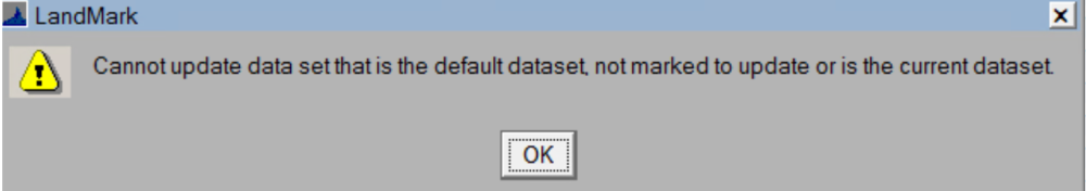
Otherwise, you will get a confirmation box.


To create a new Dataset:
Main Menu — System — Dataset Management
The Defined Datasets box will appear.
CLICK Create New button
This will open the Dataset Management Box.
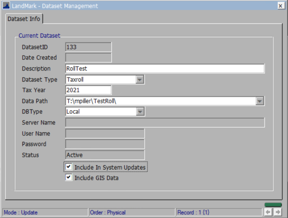
DatasetID: Autogenerated
Date Created: Autogenerated
Description: NAME the new Dataset (Example: 2022Excise or 2022TaxRoll)
Dataset Type: Dropdown Options
- Future: DON’T USE
- Other: Excise Dataset
- Taxroll: Tax Roll Dataset
Data Path: CLICK dropdown to open File Explorer.
Under the LandMark drive (L:) there will be a Datasets Folder
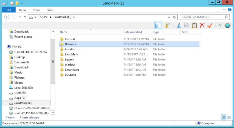
DOUBLE-CLICK the Datasets folder
CREATE a new folder and NAME the new dataset (Name Examples: 2022Excise or 2022TaxRoll)
DB Type: Local

Server Name, User Name, and Password: Autogenerated (if set up).
Include in System Updates: Check box to have dataset software update when available.
Include GIS Data: Check box to see GIS data at the time of the dataset was made.
CLICK X to save and CREATE the Dataset
Post your comment on this topic.