
The Route planning & Navigation settings adjusts how the Route computing algorithm should calculate routes for you.
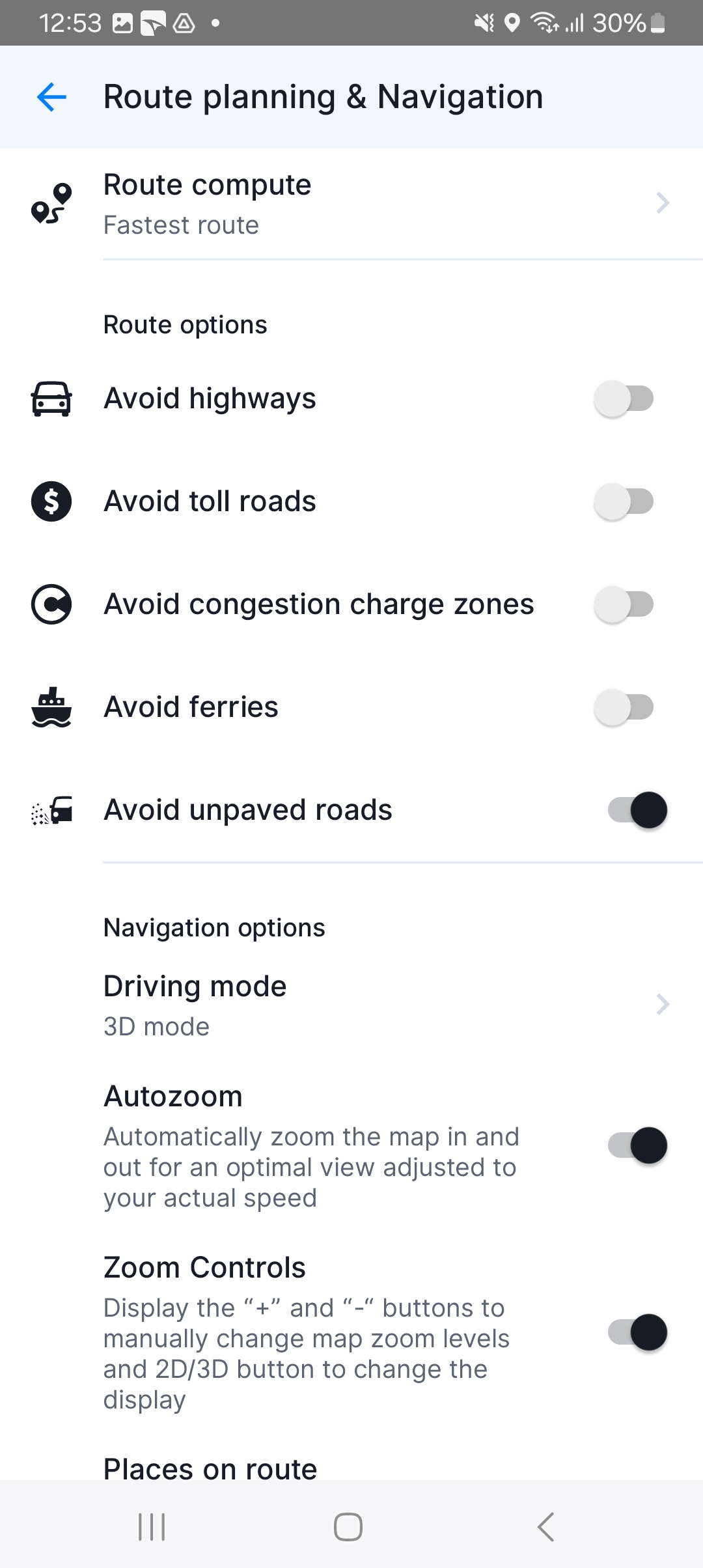
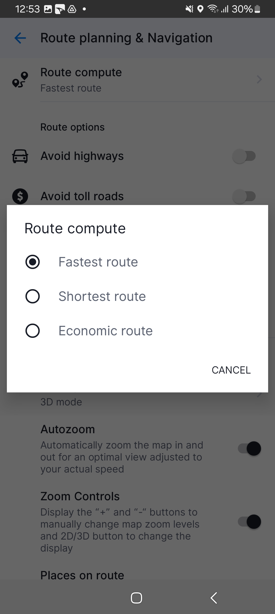
The Route Compute setting allows you to select the following:
- Fastest – route will take the least amount of time
- Shortest – routing will prefer the shortest distance to your destination
- Economic route – route which should result in the lowest fuel consumption, with as little turns as necessary.
You can enable/disable various road types to be used when computing your route:
- Avoid Highways – Avoids Highways, if possible.
- Avoid Toll Roads – Avoids Toll Roads, if possible.
- Avoid Congestion Charge Zones – Avoid various Congestion Charge zones, if possible.
- Avoid Ferries – Avoids Ferries, if possible.
- Avoid Unpaved Roads – Avoids unpaved roads, if possible.
Please note: The avoid function relies heavily on map data. The algorithm may sometimes not avoid them as expected – in that case, you can report these errors using Give Us Feedback.
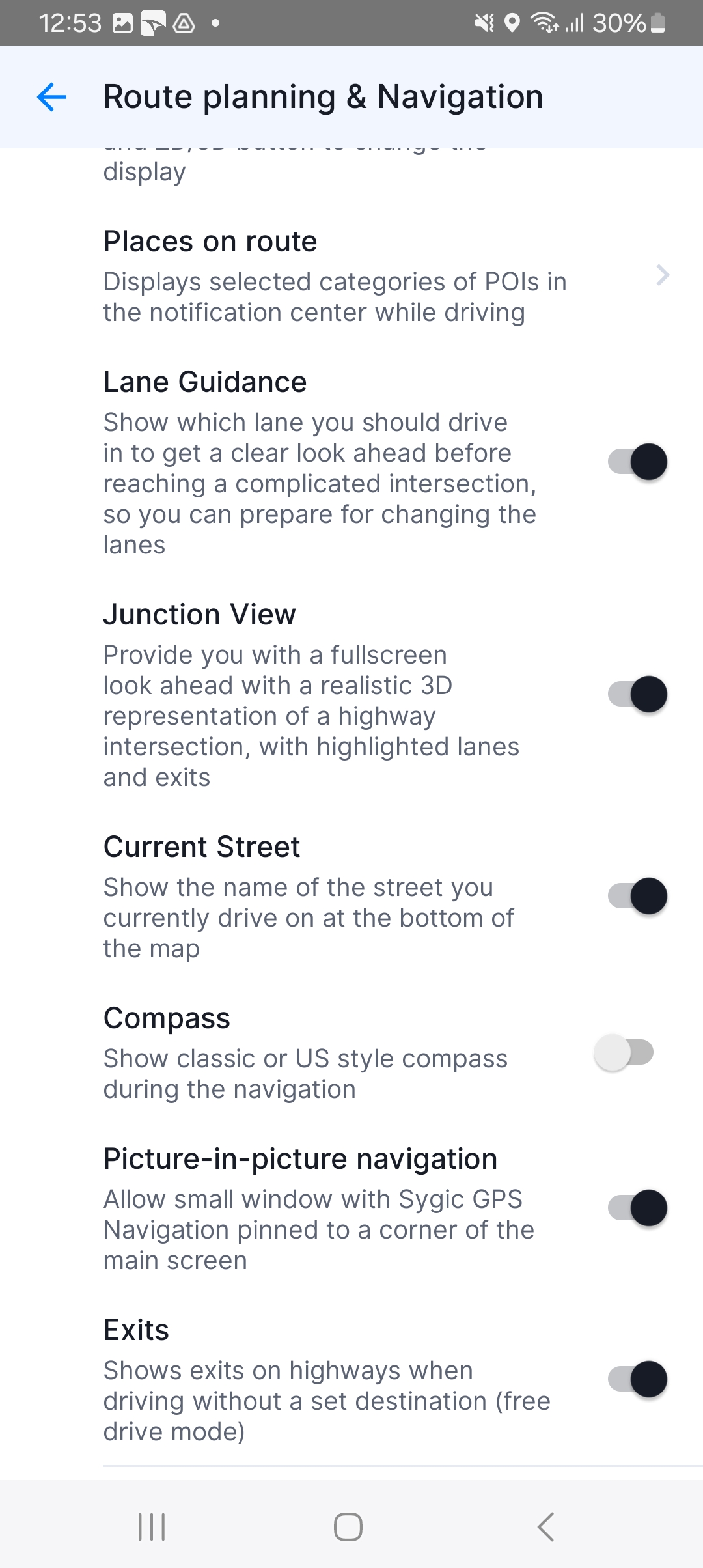
When you scroll down the screen, you will see these navigation options:
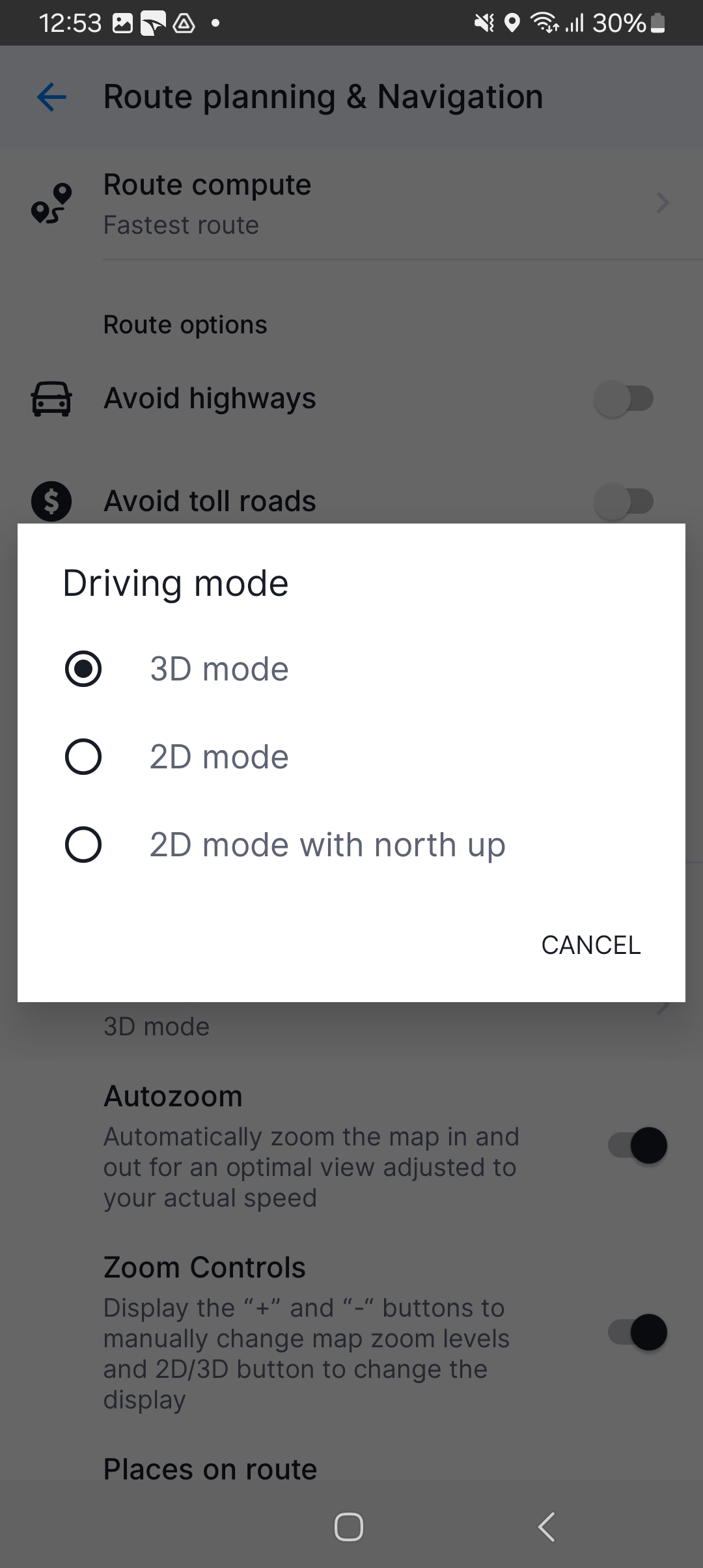
- Driving mode – Select between 3D mode, 2D mode, or 2D mode with north up
- Autozoom – Automatically zoom the map in and out
- Zoom Controls – Display the “+” and “-” button to manually change zoom levels and 2D/3D button to change the display
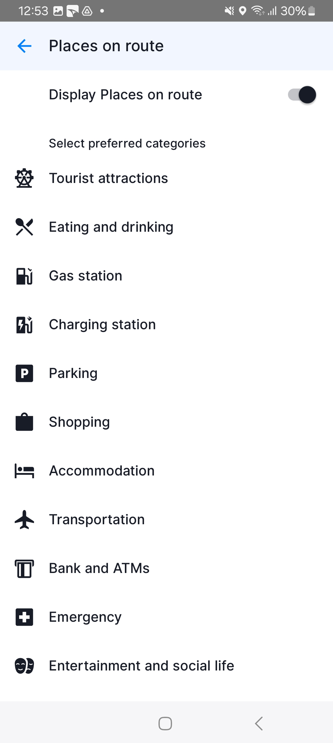
- Places on route – This setting allows you to modify displaying of places (points of interest) in the notification center on the left edge of the map screen while navigating. You can toggle the switch to turn this feature on/off, or tap on “Categories” to pick which category of Places you want to be displayed on your route.
- Lane Guidance – Show which lane you should drive in to get a clear look ahead before reaching a complicated intersection.
- Junction View – Enable/disable a realistic 3D representation of highway intersection.
- Current Street – Show the name of the street you currently drive on.
- Compass – Show the classic or US compass while driving. Classic compass is displayed when navigating outside of the US, while US compass is shown while driving in the US.
- Picture-in-Picture (PiP) Navigation – allow a window with Sygic GPS Navigation to be displayed in a corner of the main screen
- Exits – Shows exits on highways during the navigation without the destination (free drive mode)